IMA Strengthens Expertise in Oil Spill Monitoring Through Satellite Technology and International Collaboration
The Institute of Marine Affairs (IMA) has taken a significant step in the detection and monitoring of oil spills. Thanks to advanced training provided by the Satellite Analysis Branch (NAB), in collaboration with the National Oceanic and Atmospheric Administration (NOAA) of the United States, the IMA has enhanced its capabilities. Since the implementation of a comprehensive program in July 2021, the IMA has strengthened its almost real-time monitoring capacity, bolstering efforts to combat environmental hazards.

20 February 2024
The strategic collaboration between the IMA and the Ministry of Energy and Energy Industries has borne fruit. Both institutions share monitoring responsibilities on a weekly rotation. This partnership has not only strengthened response mechanisms but also laid the groundwork for a proactive approach to preventing potential oil spills.
Since its inception, the IMA has played a crucial role in various investigations. It provides satellite monitoring for minor oil spill reports and actively participates in significant incidents. One such case was the Guaracara spill in August 2021. Additionally, the IMA provided crucial support during the incident with the tanker CETUS MV, which sank in June 2022. These actions demonstrate the institution's commitment to environmental conservation.
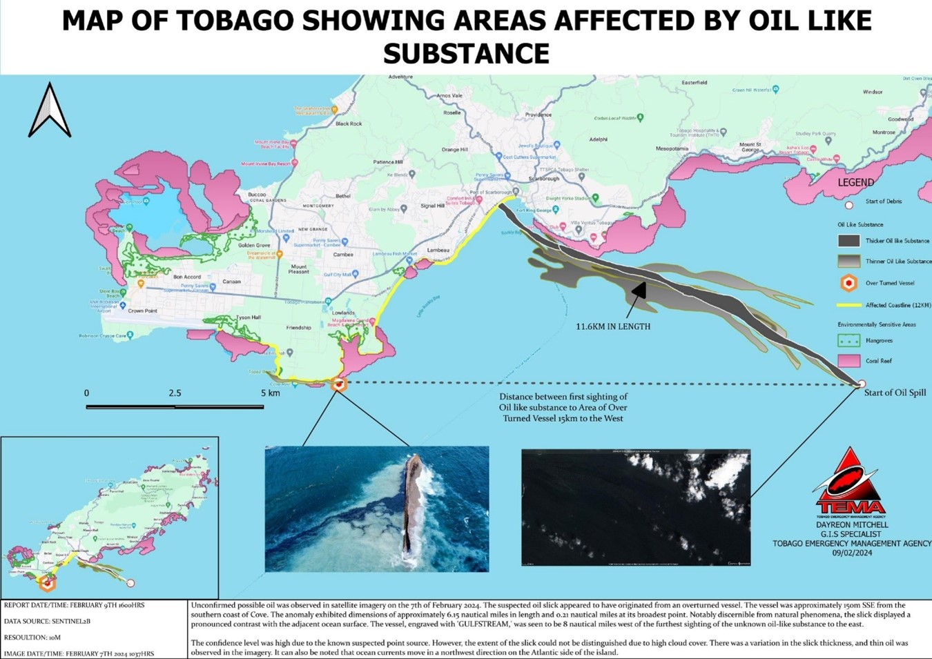
Amidst these efforts, a recent event highlights the importance of these initiatives. The report from February 12, 2024, originating from Trinidad and Tobago, reveals a critical situation in Tobago, where an overturned vessel in Canoe Bay triggered a concerning leakage of a substance similar to oil. The substance affected sensitive areas, including mangroves, turtle nesting beaches, and coral reefs.


