Tropical cyclones: Why we must observe the ocean to better protect people on land
Lessons learned from ocean observations during hurricanes Irene and Sandy pushed the U.S. to deploy a fleet of underwater robots during every hurricane season. As extreme weather events are becoming more frequent due to climate change, is it time to expand this hurricane forecasting capacity to other regions?
1 August 2023
11 years after Hurricane Sandy hit the Caribbean islands and the East Coast of the United States in 2012, its destructive power is undoubtedly still vivid in the memories of its witnesses. The largest Atlantic hurricane on record, Sandy killed 233 people across the Caribbean and North America, and brought destruction with extreme winds, mudslides and flooding that inflicted almost US $70 billion in damage.
“Just one year before that, we had Hurricane Irene, which was supposed to be a devastating storm - but then it kind of fizzled out. The next year, when alerts about Hurricane Sandy came up, people remembered Irene, and it was really difficult to convince anyone that this time it was going to be much bigger,” Dr Scott Glenn, distinguished professor at Rutgers University shares his memories. What he knew that the weather forecasters did not, was the alarming conditions below the ocean surface that warned the hurricane would be extremely powerful.
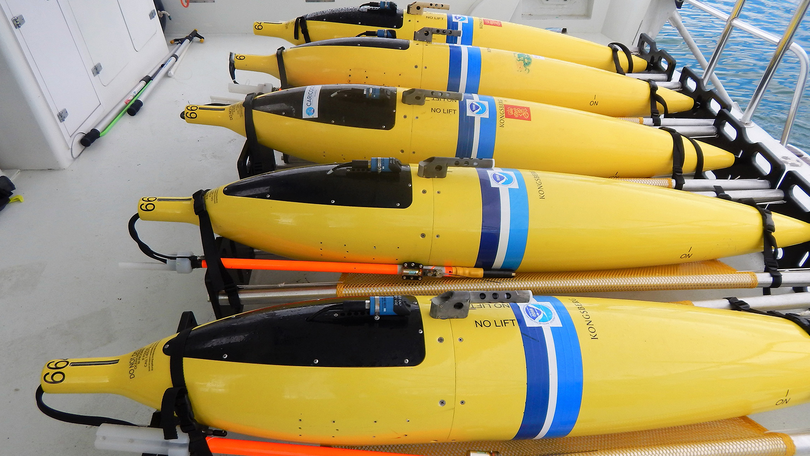
“When hurricanes Irene and Sandy hit, we had our underwater gliders - autonomous underwater vehicles that collect ocean observations, and they were deployed during both of these events. And right before Irene arrived, we saw the ocean cool very rapidly,” says Dr Glenn. “This cooling just pulled the energy out of the storm and rapidly weakened it. But there was no such cooling before Sandy, and so the heat would only fuel the storm.”
The ocean controls our planet’s water cycle, and even small changes within it can have a big impact on weather events on land. Such different ocean conditions observed before Hurricane Sandy raised serious concerns between scientists, including Dr Glenn himself, who quickly understood that this time the hurricane was not going to show any mercy.
But surprising though it may seem today, 11 years ago weather forecasts were not automatically absorbing ocean data into their models. “I had this data from the gliders in the ocean, but at that time there was no way for me to communicate this. There was no way to add it to the information stream that reaches the forecasters,” he says.

Hurricane Sandy aftermath in Haiti (Credit: Logan Abassi / UN Photo)
Hurricane forecasts today - better than in 2012, but with room for improvement
Since then, Dr Glenn and other oceanographers have worked hard to raise the importance of ocean observations in extreme event forecasting and to develop an operational system for data collection in the path of storms.
Today the U.S. boasts a full hurricane glider fleet deployed during every hurricane season. These sturdy underwater robots can withstand destructive weather conditions in order to collect and transmit near real-time ocean data into the U.S. Integrated Ocean Observing System (IOOS), a part of the Global Ocean Observing System (GOOS). Since 2018, this data is included into hurricane forecast models, contributing to timely and more accurate warnings.
“By acting as an umbrella that facilitates the flow of data across global ocean observing networks, GOOS can provide prediction centers with more comprehensive and accurate global ocean data,” says Dr Weidong Yu, Co-Chair of the Ocean Observation Physics and Climate Panel. “This enables prediction centers to issue improved early warnings for severe storms, floods and droughts, protecting more lives and livelihoods worldwide.”
The powerful Cyclone Mocha that hit Myanmar and Bangladesh this May is a recent example of the critical importance of such ocean data. “The mobilization of humanitarian agencies against the threat of Cyclone Mocha was possible thanks to the real time monitoring of ocean and meteorological variables, which resulted in reliable forecasting and timely issue of an early warning,” says Dr Yu.
The Bay of Bengal faces the most deadly tropical cyclones on our planet, and experience from this region can help improve our ability to accurately and efficiently predict extreme weather events around the world. That is why it is one of the several pilot study regions within the Tropical Cyclone Project co-led by Dr Glenn through the GOOS Ocean Observing Co-Design programme under the UN Ocean Decade. (Read more)