Impact of Hurricane Dorian on the Bahamas - Impacto del huracán Dorian en las Bahamas
Share: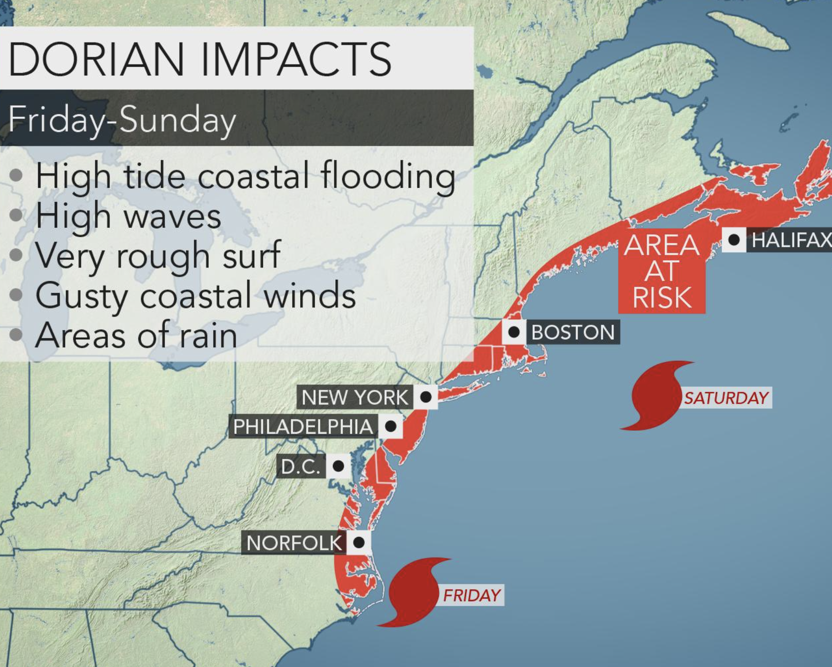
Hurricane Dorian is the fifth tropical cyclone of the season in the Tropical Atlantic, the fourth to become a tropical storm and the first to become a hurricane in 2019.
On August 24th it ceased to be the tropical depression Five to become the tropical storm Dorian. At that time, it was located about 1530km from the Lesser Antilles; later on, in August 27th, traveled through the islands of Barbados and St. Lucia.
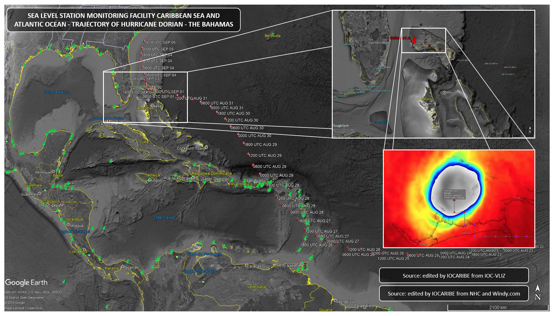
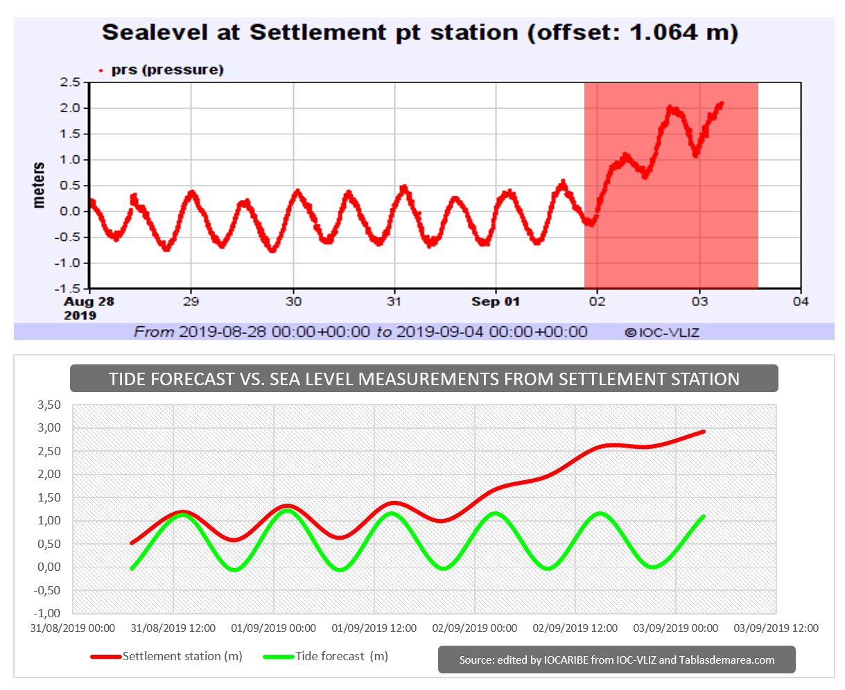
Later on, in August 28th as hurricane category 1, moved very near to the Virgin Islands and left the Caribbean Sea. On the other side, on September 1st, arrived in the Bahamas as a cyclone category 5 and stayed in that area for three days, generating a sea level increase of more than 1 meter high, causing a great flooding. Which can be appreciated when comparing tide forecasts vs the measurements recorded by the tide station of Settlement, before being affected by the hurricane. Sea level data from this station can be consulted on the website of the sea level network coordinated by IOC - Unesco "SEA LEVEL STATION MONITORING FACILITY ".
After leaving the Bahamas, this cyclone continued its displacement towards the NNW, parallel to the coast of Florida, at a distance of approximately 170km, this time decreasing its intensity and category.
Español
El Huracán Dorian es el quinto ciclón tropical de la temporada en el Atlántico Tropical, el cuarto en convertirse en tormenta tropical y el primero en pasar a huracán en este 2019.
El día 24 de agosto dejó de ser la depresión tropical Five para convertirse en la tormenta tropical Dorian, en ese momento se encontraba a unos 1530km de las Antillas menores; posteriormente, el 27 de agosto transitó por la islas de Barbados y Santa Lucia.
Luego, el día 28 de agosto ya convertido en huracán de categoría 1, transitó muy cerca a las Islas Vírgenes y salió del mar Caribe. Por otro lado, el 1º de septiembre arribó a Las Bahamas como un ciclón de categoría 5 y se mantuvo en esa área por tres días, generando un aumento del nivel del mar superior a 1 metro de altura, provocando así una gran inundación. Lo cual, se puede apreciar al comparar las pleamares y bajamares pronosticadas contra las mediciones registradas por la estación mareográfica de Settlement, antes de ser afectada por el huracán; los datos registrados por esta estación se pueden consultar en el sitio web de la red de nivel del mar coordinada por la IOC - Unesco “SEA LEVEL STATION MONITORING FACILITY “.
Después de salir de las Bahamas, este ciclón continuó su desplazamiento hacia el NNW, paralelo a la costa de la Florida, a una distancia aproximada de 170km, esta vez disminuyendo su intensidad y categoría.