For the first time underwater gliders are launched off the coast of Dominican Republic to improve hurricane intensity forecasts and disaster risk reduction
Share:
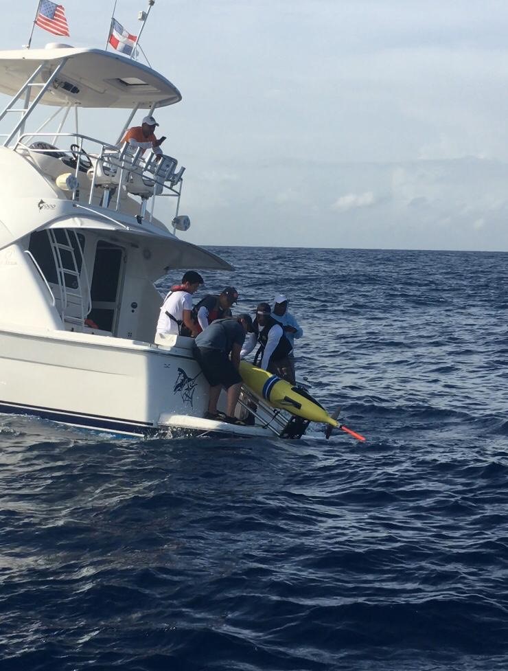
On August 15 2019 for the first time an underwater glider was launched off the coast in Dominican Republic waters, 5 miles to the south of Bocachica. The glider will monitor the ocean waters in this region during the next three months providing high-value data to be used daily and in real-time for weather and hurricane forecasts. This activity is a part of the IOCARIBE-GOOS of IOC of UNESCO pilot project on improvement of Hurricane Observing Forecasting Capacity developed jointly with national institutions and universities in a multi-institutional effort that brings together the research and operational components to implement and carry out sustained and targeted ocean observations from underwater gliders in the Caribbean Sea and south-western tropical North Atlantic Ocean.

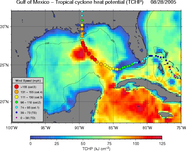
Hurricane Katrina. Temperature and Salinity to 500 to 1000m deep need to be continuously monitored during hurricane season to improve intensity forecasts
This effort is led by the US National Oceanic and Atmospheric Administration (NOAA) and its Atlantic Oceanographic and Meteorological Laboratory (AOML), and the US Integrated Ocean Observing System (IOOS) working jointly with the Dominican Republic National Authority of Marine Affairs (ANAMAR), the National Office for Meteorology (ONAMET) and the Dominican Republic Navy. The partnership also includes IOOS Regional Associations, the University of Puerto Rico (Mayaguez); the Bahamas (Cape Eleuthera Island School); Rutgers - the State University of New Jersey, University of Miami, CIMAS, University of Georgia, and University of Southern Mississippi.


