login
login
Tracking Sargassum in the Caribbean Sea and the Gulf of Mexico
Share: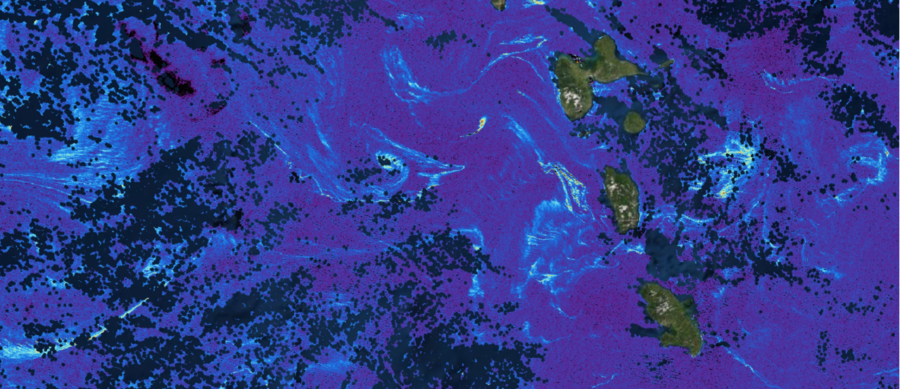
The image above is a sample of today's field of Maximum Chlorophyll Index (MCI) from ESA's OLCI Sentinel-3 sensor. The NESDIS CoastWatch Caribbean and Gulf of Mexico regional node at AOML distributes these fields, which are used to track Sargassum into the Caribbean Sea and Gulf of Mexico. These products are also used to monitor Sargassum inundation events, which is when high concentration of Sargassum reach the coastal areas. These fields, as well as other sargassum-related indexes (e.g. University of South Florida's AFAI) are available from the following links:
Ocean Viewer (https://cwcgom.aoml.noaa.gov Select Sargassum on left menu), and https://oceanwatch.aoml.noaa.gov/erddap/griddap/DAILY_MCILOLCI.graph
Sargassum inundation reports can be found at: https://www.aoml.noaa.gov/phod/sargassum_inundation_report/